
LightPlan
Know where the light will fall
Plan the sun, moon and shadows in 3D for landscape, architecture and real estate, and astrophotography. See which side of a building gets the sun, when golden and blue hour start, and where the Milky Way will rise, so you know exactly when the light will be right.
Plan the sun, moon and shadows in 3D for landscape, architecture and real estate photography. Free on iPhone, iPad, Mac and Android.


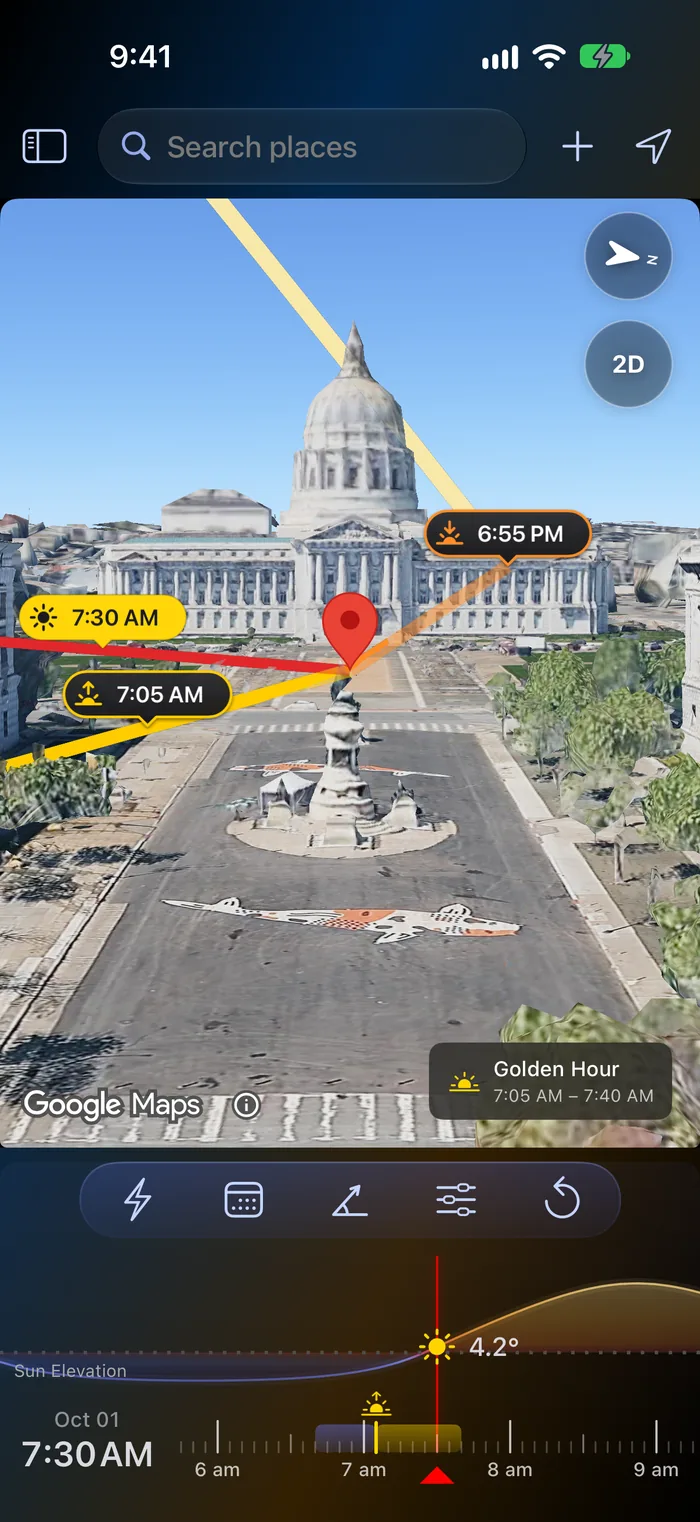
Built for architecture and real estate photographers
See when the sun reaches a facade, where the shadows fall and when blue hour starts, for any property, before you book the shoot.
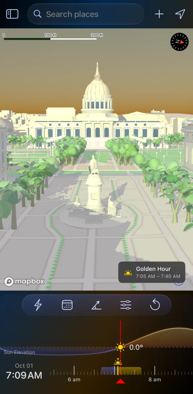
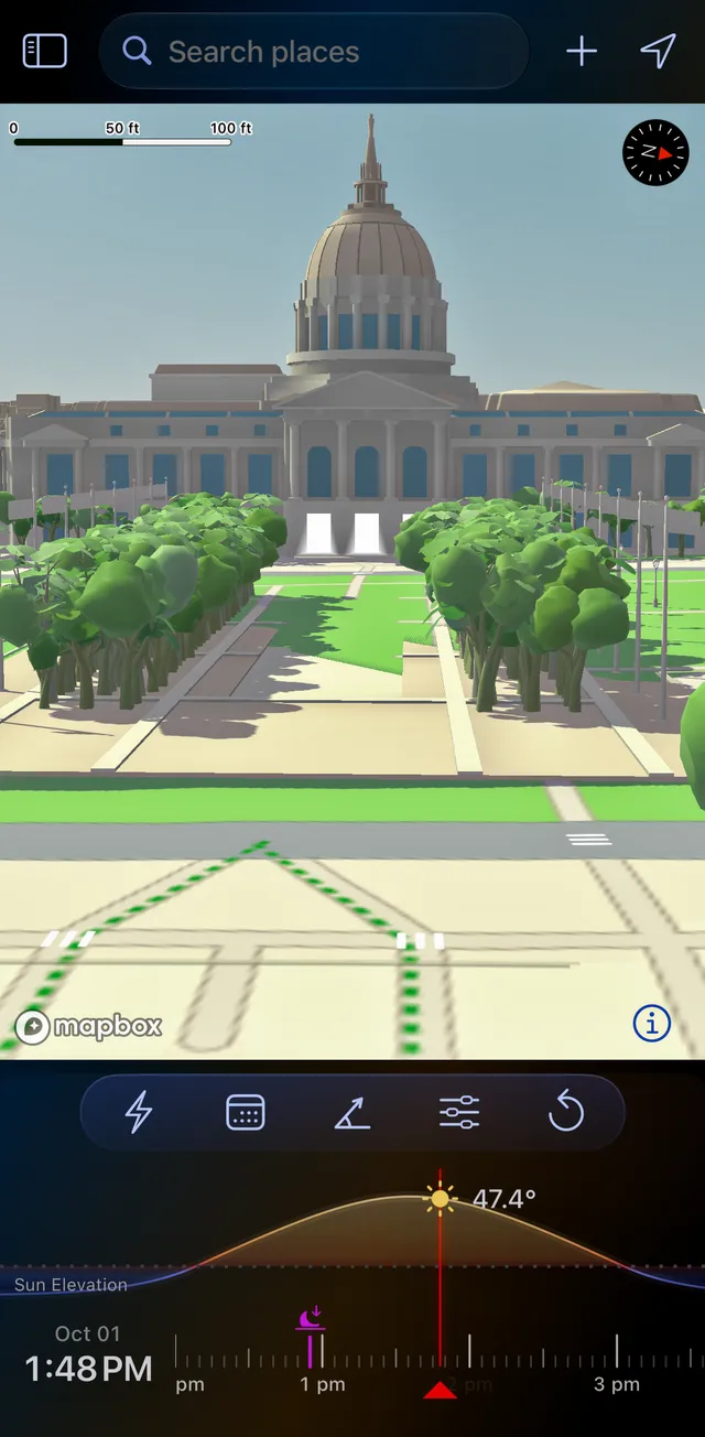
- Which side gets the sunSun lines over Google's photorealistic 3D buildings show when the sun swings onto the facade you need.
- Shadows on siteShadow Map shows where neighbouring buildings and trees cast shadows at any hour (Pro).
- Twilight exteriorsBlue hour to the minute, in the property's own time zone, with alerts and Add to Calendar.
- Street, roof or droneObserver View frames the building with your lens, from standing height up to 1000 m (Pro).
- Send it to the clientPlan links open on a 3D map on the web, with the light windows and directions.
Get the Perfect Shot Everytime
Plan your photography with confidence and capture stunning images every single time.
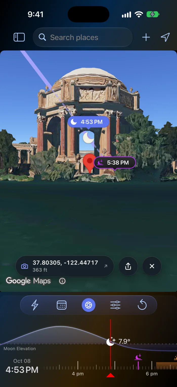
Observer View NEW
Stand where you'll shoot. Drop a pin and LightPlan puts you at eye level to watch the sun or moon cross the real skyline, with your lens from 14 to 600 mm. Line up the moon on a summit weeks ahead.
AR Sky View NEW
Hold up your phone to see the sun's and moon's paths across the real sky, hour by hour, from where you're standing. Free on iPhone, iPad and Android.
Share a Plan NEW
Send the exact place, time and view in one link. It opens in LightPlan, or on a 3D map on the web for friends who don't have the app, with the day's light and directions.
LightPlan on Mac NEW
The whole planner on a big screen, with your saved locations synced from iPhone and iPad through iCloud. Same App Store download.
3D Sun & Moon Visualization
See exactly where the sun and moon will be in stunning 3D environments. Visualize celestial paths overlaid on Google Maps with precision timing.
Golden & Blue Hour Planning
Never miss perfect lighting conditions. Interactive timeline shows golden hour, blue hour, sunrise, and sunset times with elevation charts.
Milky Way Planner
Nail the galactic core every time. See exactly when and where the Milky Way rises, its azimuth and altitude over your scene, and which nights fall in Milky Way season — so you can frame the core above your foreground instead of guessing.
Moon Phase Calendar
Plan a month ahead at a glance. The moon phase calendar shows new moons, full moons, and illumination percentage for every day — pinpoint dark-sky nights for astrophotography or full-moon light for landscapes without doing the math.
Shadow Map
See real shadows from buildings and terrain at any time. Watch how sunlight creates and transforms shadows throughout the day and across seasons. Perfect for photographers planning shoots, architects analyzing site conditions, or anyone wanting to understand how light shapes their environment.
3D Terrain Map
See the landscape in true elevation. The 3D terrain map renders real mountains, ridgelines, and valleys so you know whether a peak will block the sunrise or reveal it — essential for scouting where light actually reaches your composition before you make the drive.
Weather Overlay Layers
Light timing is only half the shot — the sky has to cooperate. Toggle cloud cover and precipitation forecasts as live heatmap overlays right on the map to spot clear windows, dramatic partial clouds, or rain moving in, and pick the night that will actually deliver.
Home Screen Widgets PRO
Stay updated with stunning widgets on your home screen. View sun & moon positions, golden hour times, and the dedicated Milky Way widget showing tonight's galactic core visibility — all at a glance without opening the app. Part of LightPlan Pro, with a 14-day free trial.
Made for iPhone Duo
LightPlan adapts to Apple's foldable iPhone. Open it out for a wide view of the scene and the timeline together, or fold it closed and keep planning on the outer display.
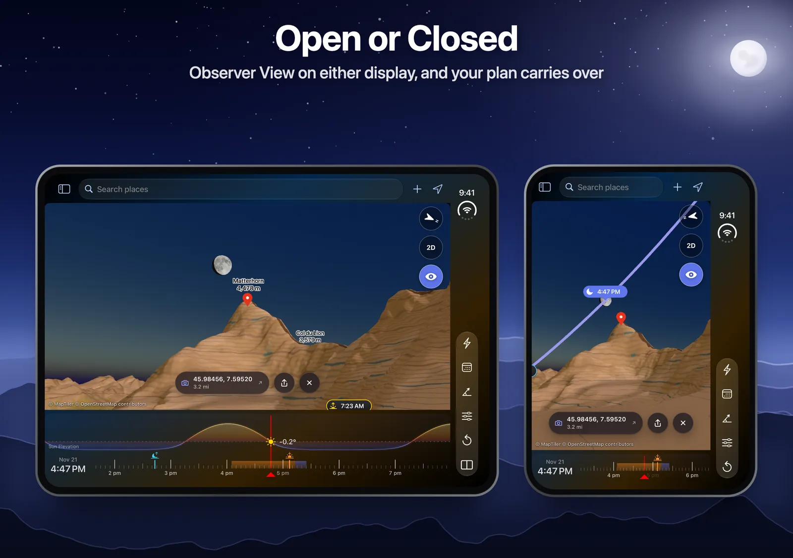
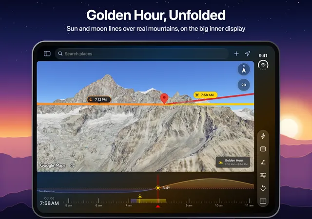
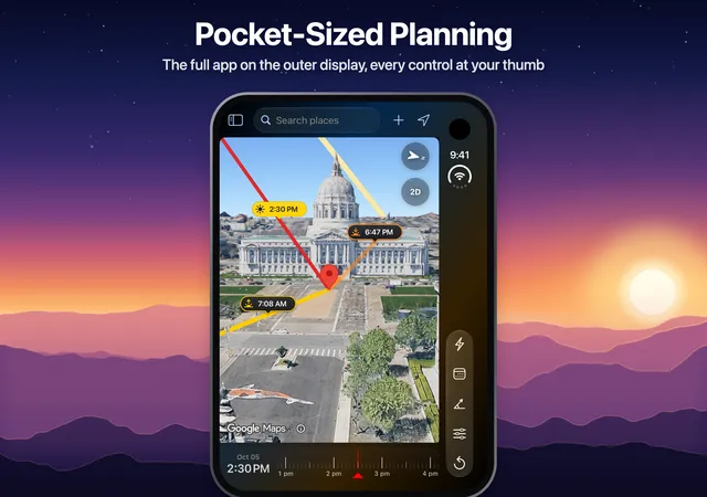
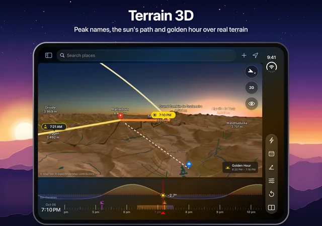
Opened out and turned sideways, Split View shows LightPlan's Shadow Map beside the main map, so you see the light and the shadows together.
See LightPlan in Action
Explore LightPlan's stunning interface and discover how easy it is to plan perfect photography with 3D visualization.
Learn the Basics
The color overlays depict the angle of Sunrise, Sunset and Sun's angle at the selected time for any location.
Navigating the timeline
Easily scrub through time to find the perfect lighting conditions for your shoot.
Shadow Visualization
View real-time shadows of buildings and objects based on sun position for any location.
Add Locations
Easy as a tap to move the marker to your desired location. Organize saved locations for quick access.
Frequently Asked Questions
Everything you need to know about LightPlan's features and capabilities.
What's new in LightPlan 3.0?
LightPlan 3.0 (October 2026) adds Observer View, which puts you at eye level where you'll stand to watch the sun or moon cross the real skyline; AR Sky View, which shows the sun's and moon's paths on the real sky through your phone's camera; LightPlan on Mac, with saved locations synced through iCloud; and plan links that open in the app or, for friends without it, on a 3D map on the web.
Does LightPlan have augmented reality (AR)?
Yes. AR Sky View shows the sun's and moon's paths across the real sky, hour by hour, through your phone's camera, with calibration against the real sun or moon. It's free on iPhone, iPad and Android.
Is LightPlan available on Mac?
Yes. LightPlan runs on iPhone, iPad and Mac from the same App Store listing, with saved locations synced through iCloud, and on Android from Google Play.
What makes LightPlan different from other sun/moon apps?
LightPlan offers 3D visualization with Google Maps integration, allowing you to see exactly how sun and moon positions relate to actual terrain and landmarks. Plus features like custom camera angles and location organization.
What types of photography is LightPlan best for?
LightPlan is built for any photography where natural light matters: landscape and nature, architecture and real estate, cityscapes, golden hour portraits, and astrophotography and the Milky Way.
Is LightPlan good for architecture and real estate photography?
Yes. LightPlan draws the sun's direction at any time over Google's photorealistic 3D buildings, so you can see which facade is lit before you book the shoot. Shadow Map shows where buildings, trees and terrain cast shadows, blue hour is timed to the minute for twilight exteriors, Observer View frames the building from the street, a rooftop or a drone with your focal length, and plan links send the shoot to a client or agent who doesn't have the app. Planning architecture and real estate shoots.
What's included in the free version?
LightPlan is free to use every day, with no account and no time limit. The free version includes sun and moon lines and rise and set times for any place on Earth, golden hour and blue hour, today and the next 2 days, up to 5 saved locations, Photorealistic 3D, Terrain 3D and 2D maps with camera presets, AR Sky View, the 3D Compass, the Moon Calendar, the Milky Way Planner (any free date, plus the 3 best nights ahead), sunrise and sunset alerts, and shareable plan links. See Free vs Pro.
What additional features do I get with Pro?
LightPlan Pro ($2.99 a month or $19.99 a year in the US) starts with a free trial and adds any date (years ahead or back), unlimited saved locations, Observer View, Shadow Map, weather layers with cloud cover and precipitation forecasts, the full 30-night Milky Way forecast with alerts and the core in AR, every alert on the days you choose, and Home Screen and Lock Screen widgets.
Is LightPlan good for astrophotography?
Absolutely! Track moon phases, plan moon rise/set timing for night photography, and use precise positioning to avoid moon interference with Milky Way shots.
Can I use LightPlan for location scouting?
Yes! The 3D Google Maps integration lets you scout locations remotely, visualize how light will interact with terrain, and save promising spots with custom camera angles.
Can LightPlan plan Milky Way photography?
Yes. The Milky Way Planner shows exactly when the galactic core rises, its azimuth and altitude over your scene, and which nights fall within Milky Way season. Combined with the moon phase calendar to find dark-sky nights, you can frame the core above your foreground with confidence — and the Milky Way home screen widget (Pro) keeps tonight’s visibility one glance away.
Does LightPlan show the weather and cloud cover?
Yes — weather overlay layers are part of the Pro subscription. They render cloud cover and precipitation forecasts as heatmap overlays directly on the map, so you can spot clear windows, dramatic partial clouds, or incoming rain and commit to the night and location that will actually deliver, instead of driving out to a clouded-over sky.
Is there a moon phase calendar?
Yes. The moon phase calendar shows new moons, full moons, and the illumination percentage for every day, so you can plan a month ahead at a glance — dark, moonless nights for astrophotography and the Milky Way, or bright full-moon light for nighttime landscapes.
Can I see how terrain and mountains affect the light?
Absolutely. The 3D terrain map renders real elevation — mountains, ridgelines, and valleys — so you can see whether a peak will block the sunrise or reveal it before you travel. Paired with Shadow Map, it shows exactly where and when light reaches your composition.
Master Photography Planning
Learn from professionals how to use light prediction for stunning landscape, nature, and astrophotography.
Architecture & Real Estate Photography
See when the sun reaches a facade, where the shadows fall and when blue hour starts, for any property, before you book the shoot.
Read full guide →Landscape Photography Planning Guide
Master the art of planning landscape shots using sun and moon positions. Learn optimal timing for dramatic skies and perfect lighting.
Read full guide →Mastering Golden Hour & Blue Hour
Discover the secrets of golden hour timing and blue hour magic. Learn how to predict and capture the most beautiful natural lighting.
Read full guide →Astrophotography Planning
Plan perfect night sky photography with moon tracking and Milky Way timing. Master the art of celestial photography planning.
Read full guide →Loved by Professional Photographers
See why landscape and nature photographers rely on LightPlan for their most important shoots.